Live Earth Map: Street View 3D
- 4.1
- Rating
- 10.00M
- Installs
- Free
- Price

 Analysis by App-foxy
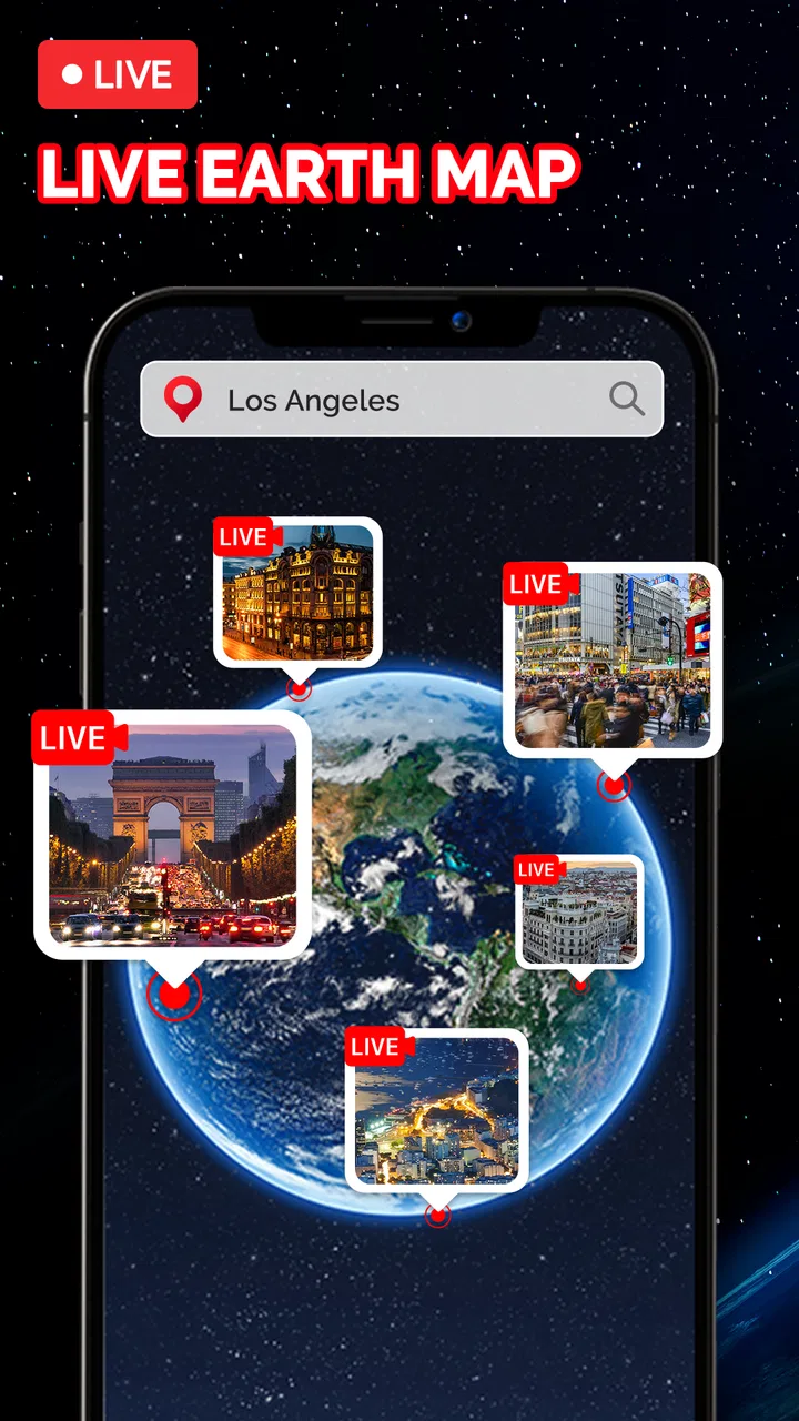
Live Earth Map: Street View 3D is the kind of travel app I open when I want to understand a place before going there, rather than simply look up its name on a map. It combines an interactive earth view with street-level imagery and satellite imagery, so I can move from a broad view of a country or coastline toward the roads and neighborhoods that matter to me. That change of scale is its main appeal: it gives a trip-planning question a visual answer.
I found it most useful as a visual companion to ordinary navigation tools. It is not the app I would trust alone for turn-by-turn driving, current traffic, or precise local directions. Instead, I use it to get a feel for an entrance, inspect the surroundings of a hotel, understand the shape of a coastal road, or revisit a familiar location from home. The experience depends heavily on a stable connection, and that is important to understand before installing it.
What the app is really like to use
Developed by Droid-Developer, this free Travel & Local app is available for everyone and runs on devices using Android 6.0 or later. Its current version is 2.12, and the app has passed ten million installs. Those figures suggest that it has found a broad audience, but the large audience does not change my main advice: treat it as an exploration and visual-reference tool, not a complete replacement for a dedicated navigation service.
You May Also Like

 AccuWeather: Weather Radar
AccuWeather Review: A Quick, Clear Forecast for Everyday Decisions
For everyday plans, the best forecast is the one you can understand quickly. AccuWeather makes rain timing, radar, and local conditions easy to act on, with a few trade-offs.

 Hill Climb Racing
Why Hill Climb Racing Still Turns Crashes Into One More Run
A tiny car, a bumpy hill and one more upgrade: Hill Climb Racing keeps resurfacing because its simple chaos makes every near-miss feel personal.

 AliExpress - Shopping App
AliExpress Makes Global Shopping Feel Personal, but Shoppers Bear the Risk
AliExpress turns a global marketplace into a pocket-sized discovery engine. Its reach is useful, its shopping loop compelling, and its trade-offs easy to miss.

 Lords Mobile: Kingdom Wars
Lords Mobile Is a Kingdom-Building Routine, Not a Quick Match
A case-by-case verdict on the building, battles, device demands, and social commitments that make Lords Mobile rewarding for some players and exhausting for others.

 PDF Scanner app - TapScanner
TapScanner Makes Paperwork Easier to Capture, Check, and Share
TapScanner makes scanning with a phone feel less like a rescue operation and more like a dependable step in getting work done. Its capture tools are useful, though not flawless.

 Block Blast!
 Shows How Much a Puzzle Game Can Leave Out
A quiet grid game shows why puzzle players increasingly value instant clarity, repeatable skill and low-pressure play—and where the genre still needs to catch up.
More From Our News Desk
View All News


The first thing I notice is the difference between looking at a standard map and exploring a place through imagery. A conventional map is excellent for names, routes, and distances. Live Earth Map: Street View 3D is more useful when the question is, “What might this place actually look like?” Satellite view helps with the larger layout, while street-level imagery can make a destination feel more familiar before I arrive. That extra context is especially valuable when a written address tells me very little.
The interface works best when I have a clear purpose. Wandering around randomly can be enjoyable, but it is easy to lose time jumping between locations. I get more from it when I start with a practical question: where is the entrance, what surrounds this landmark, does the road appear narrow, or is the neighborhood mostly urban? Having that question in mind makes the app feel less like a novelty and more like a useful research step.
Why a strong connection changes the experience
Imagery-heavy exploration naturally places a greater demand on the network than a simple text-based map. When the connection is good, moving between the globe, satellite imagery, and street-level views feels much more fluid. I can zoom out to understand the region, zoom in to examine a block, and then switch perspective without the experience becoming a constant wait.
When the connection is weak, the same journey becomes less predictable. Images may take longer to appear, and the visual flow can lose its rhythm. This matters because the app’s appeal comes from seeing detail, not merely reading labels. A slow connection does not just delay a result; it interrupts the central activity of exploring a place.
I would therefore use it on reliable home Wi-Fi when I am planning a trip in detail. In a hotel, airport, or busy public area, I would expect a less consistent experience and would avoid making the app my only source of location information. A standard map app is usually better for quickly checking a route under pressure, while this one rewards patience and visual browsing.
Useful mobile situations beyond vacation planning
Travel planning is the obvious use case, but I found several everyday situations where the imagery is more helpful than I expected. If I am meeting someone at an unfamiliar building, looking at the surrounding streets can help me recognize the approach. If I am considering a walking route, satellite imagery can provide a broader sense of parks, blocks, and open areas before I commit to it.
It can also help when comparing possible accommodation locations. A listing may give an address, but the surrounding imagery can reveal whether the property appears close to a main road, near a dense commercial area, or in a quieter residential setting. I would not treat the imagery as a guarantee of current conditions, because streets and buildings change, but it gives me useful visual context that a short description often misses.
Another practical use is preparing for a visit with accessibility or mobility concerns. I can inspect the general approach to a place and look for visual clues about slopes, road layout, or nearby open space. This is not a substitute for confirmed accessibility information, and imagery may not show every relevant detail, but it can help me identify questions to ask before traveling.
The mobile format has a trade-off. A phone screen makes it easy to explore while sitting on a train or waiting for an appointment, but detailed imagery is more comfortable on a larger display. I prefer a tablet or desktop-sized screen for careful comparison, while the phone is better for quick checks and spontaneous discovery.
Three habits that make exploration more useful
My first useful habit is to begin wide and narrow gradually. I start with the earth or satellite perspective to understand the area’s geography, then move toward the specific street or landmark. Jumping immediately into street imagery can hide the wider relationship between the destination and nearby roads, water, parks, or districts.
My second habit is to compare more than one viewpoint before drawing a conclusion. A single street image can make a place seem unusually quiet, crowded, open, or closed off. Looking along the road and checking the surrounding blocks gives a more balanced impression. This is particularly important when I am evaluating a hotel area or planning where to meet someone.
My third habit is to use the app shortly before making a practical decision, while still verifying important details elsewhere. Imagery can be older than what I see in person, and temporary construction, changed entrances, weather, vegetation, or traffic conditions may not be represented. The app is strongest for orientation and visual familiarity, not for promising that a scene will look exactly the same on arrival.
What happens when the app struggles
Connectivity problems are the main source of friction in my experience. If imagery does not load smoothly, I do not keep tapping repeatedly. I first stop moving around the map and give the current view time to finish loading. Rapidly changing location or perspective can make a weak connection feel even worse because the app is continually being asked for new visual content.
If that does not help, I switch temporarily to a simpler map app to confirm the address or route, then return to this app when I have a better connection. That two-app workflow is more reliable than expecting one tool to handle every part of a journey. It also prevents a visual loading delay from turning into a missed appointment or a wrong turn.
For trip preparation, I recommend checking important places in advance rather than waiting until I am standing outside with limited connectivity. I note the visual landmarks that matter to me, such as a distinctive corner, entrance, bridge, or nearby open space. I still verify the real-time details through another source, but the earlier visual review makes the destination easier to recognize.
There is also a mental recovery step worth mentioning. When the app shows an incomplete or slow-loading image, I avoid treating the first visible detail as the whole picture. A partially loaded scene can create a misleading impression of a road or building. Waiting for the view to settle, then checking adjacent perspectives, produces a much better result than making a decision from one fragment.
Using it carefully on mobile data
Because the app centers on maps and imagery, I would be cautious about using it continuously over mobile data. I do not leave it open while casually moving across a large city unless I genuinely need the visual exploration. For most trips, I use it in short sessions: identify the place, inspect the relevant surroundings, and close it when I have learned what I needed.
A good data-conscious workflow is to research at home, focus on a small area, and avoid repeatedly zooming out and back in without a reason. Wide exploration followed by detailed street views can become an enjoyable rabbit hole, but it is also the easiest way to consume time and connection capacity without gaining practical information.
I also avoid using the app as a background companion during a full day of sightseeing. It is more efficient to check a few destinations before leaving, then use a conventional navigation tool for live movement. This division of labor makes sense: Live Earth Map: Street View 3D helps me understand places visually, while a navigation app is generally better suited to immediate route decisions.
The free download makes trying it straightforward, although in-app purchases range from $5.99 to $39.99 per item. I would not install it assuming that every part of the experience is necessarily included without cost. Before committing to any paid option, I would first spend time with the basic experience and decide whether its imagery and exploration style genuinely fit my needs.
Where it beats ordinary map alternatives
Compared with a standard map, this app feels more inviting when I want to inspect a destination rather than simply reach it. Satellite imagery gives me a useful sense of layout, and street-level exploration can reduce the uncertainty of arriving somewhere unfamiliar. That is a real advantage for travelers who think visually or feel more comfortable after previewing a location.
Compared with a dedicated navigation app, however, it is less suitable as the main tool during a journey. I would choose the navigation specialist for current route guidance, efficient driving decisions, and quick address searches. I would choose this app when the question involves appearance, surroundings, or spatial familiarity.
It also differs from simply searching for photos of a destination. Search results often show selected images, while map-based exploration lets me examine the relationship between streets and nearby places. That broader context is more useful when I need to understand how a destination fits into its neighborhood rather than admire one attractive photograph.
The limitation is that visual detail can create false confidence. Seeing a road does not confirm its current condition, and seeing a building does not guarantee that the entrance, business, or surroundings remain unchanged. I consider the imagery a strong starting point, but I would confirm time-sensitive information through current local sources.
Who should install it, and who should skip it
I recommend it to travelers who like to preview destinations, people comparing areas before booking accommodation, students exploring geography, and anyone who finds visual context easier than abstract map symbols. It is also enjoyable for armchair exploration when I want to understand the shape of a distant place without planning a complete trip.
I would be more cautious recommending it to someone who mainly wants turn-by-turn directions, live traffic information, or a lightweight map that loads quickly on a poor connection. Those users are likely to be happier with a conventional navigation app. The same applies to anyone who expects every image to represent current conditions exactly.
The 4.1 average from around sixty-seven thousand ratings suggests a generally positive reception, while roughly one and a half thousand written reviews indicate that many users have chosen to describe their experience in more detail. I see that as encouraging, but my own decision would still depend on the intended use. A well-liked visual exploration tool can remain the wrong choice for someone seeking a fast navigation utility.
My connectivity verdict
After using it as a location preview and exploration tool, I see Live Earth Map: Street View 3D as a useful addition to a travel folder rather than the only map on my phone. Its best moments happen when I have a stable connection, enough time to inspect an area, and a specific reason to move between satellite and street-level views.
The app is at its most practical when I use it before a journey: preview the destination, identify visual landmarks, compare the surrounding area, and then switch to a dedicated navigation tool for the actual trip. That workflow also reduces unnecessary mobile-data use and gives me a fallback when imagery takes too long to load.
My recommendation is simple: install it if visual familiarity matters to you, but keep your expectations tied to connectivity and purpose. It can make an unfamiliar place feel less abstract and help answer questions that a basic map cannot. It is not a replacement for current directions, and it should not be treated as a guarantee of present-day conditions. As a free Travel & Local app from Droid-Developer, with an Everyone rating and support for Android 6.0 and above, it is easy to try; its real value appears when I use it deliberately rather than continuously.
FAQs for Live Earth Map: Street View 3D
01What is Live Earth Map: Street View 3D?
Live Earth Map: Street View 3D is a map and exploration app designed to let users view locations around the world through satellite imagery, map data, street-level views, and three-dimensional presentations where available. It can be useful for checking unfamiliar places, planning trips, exploring landmarks, and getting a general impression of an area before visiting. The exact imagery and available features may vary by location.
02Does Live Earth Map: Street View 3D provide real-time street views?
Despite the word “Live” in its name, the application should not be understood as a continuously updated live camera feed. Street and satellite images are generally collected in advance and may be days, months, or even years old. Coverage, image quality, and update frequency depend on the map provider and the selected location, so users should verify important details with current local information.
03Does the app require an internet connection to work?
Yes, an internet connection is normally required for searching places, loading map tiles, displaying satellite imagery, and opening street or 3D views. Performance can depend heavily on connection speed and signal strength, especially when viewing detailed imagery. Some map information may be cached temporarily, but users should not assume that the application offers complete offline navigation or downloadable maps unless that option is clearly provided.
04Is Live Earth Map: Street View 3D free to download and use?
The application may be available as a free download, but some functions can be supported by advertising, optional purchases, or a subscription depending on the version and platform. Before confirming a purchase, review the app’s store listing carefully for pricing, trial conditions, renewal terms, and included features. Removing ads or unlocking advanced map and 3D tools may require payment.
05Is Live Earth Map: Street View 3D accurate and suitable for navigation?
The app can be helpful for visual exploration, route preparation, and understanding the layout of a neighborhood, but it should not automatically replace a dedicated navigation service or official local guidance. Map data, business details, road conditions, and street imagery can become outdated. For driving, walking, emergencies, or time-sensitive travel, compare the app’s information with current navigation data and local signs.
Pros
- Explore realistic 3D satellite imagery of cities and landmarks worldwide.
- Street View mode makes virtual sightseeing feel immersive and interactive.
- Search tools help locate destinations
- addresses
- and notable places quickly.
- Useful for planning trips and previewing unfamiliar neighborhoods remotely.
- Includes geographic information that can support basic route and location research.
Cons
- Image quality and coverage can vary significantly between locations.
- Some advanced map and viewing features may require in-app purchases.
- The app may use considerable data when loading detailed imagery.
- Frequent location updates are not guaranteed for every area.
- Performance may feel slow on older devices or weaker connections.

Live Earth Map: Street View 3D
Gallery